Educational Adventures in Arizona

Discover Arizona's unique beauty, scenic diversity, and colorful history! We are a homeschool family that enjoys learning about Arizona’s history, geography, and environment while exploring every corner of the state together. We invite you to join us on our family’s adventures in Arizona, the Southwest, and beyond.

Tuesday, December 04, 2007

THANKSGIVING TRIP ~ November 22-25, 2007

I don’t know about you, but the day after Thanksgiving my e-mail inbox was inundated with special sales, deals, and other offers. It seems that everyone was jumping on the “Black Friday” bandwagon. Of course I love a good sale as much as everyone else, but I don’t see why we have to be bombarded all at once over Thanksgiving weekend when most of us would rather be spending time with our families than spending money on retail commodities. Okay, I admit being a little disappointed at having to miss out on some such giveaways because I was busy traveling with my husband and children... but we had great fun on our trip together so I suppose it was a worthy trade-off!

After a big turkey dinner, we brought some leftovers with us and spent Thanksgiving night camping out in the middle of the California desert.

On Friday morning we went to the General Patton Museum.


Later on Friday afternoon and evening we took a look at Hollywood, the Santa Monica Pier, and the Third Street Promenade.

On Saturday we saw the big cloud of smoke from the Malibu fire, but the highlight of the day was getting to meet evangelist and author Ray Comfort who was open-air preaching at Huntington Beach.


On Sunday we drove back to Arizona via Route 66 from San Bernardino to Victorville and through Barstow, Amboy, and Needles.


We had a long distance to go so we didn't have much time to stop and explore along the way, but the area around Amboy in particular was a beautiful scenic (and desolate!) part of the Mohave Desert that I would love to visit again soon.


I hope you are taking an opportunity to enjoy some quality time with your families and loved ones amid the hustle and bustle of the holidays.

Click on this link to read our family newsletter:

http://www.knowledgehouse.info/Xmas%20Letter%202007.pdf

Labels: , , , , , , , , , , , , , , , , , ,

Monday, June 11, 2007

BEALE WAGON ROAD, 150th ANNIVERSARY ~ June 9, 2007

Coincidentally, the same year that I discovered the historic Beale Wagon Road also happens to be the Beale Wagon Road’s 150th Anniversary! I was excited to see that historian Jerry Snow, a docent at the Museum of Northern Arizona, was going to be presenting a free lecture and slide show about the Beale Wagon Road at 7:00 pm on June 9, at Riordan Mansion State Historic Park. The park grounds closed at 5:00 pm, but the gates re-opened at 6:30 for guests to attend the presentation.

I was surprised at how many visitors turned out for this topic – the audience contained at least 40 people. However, most of them were older retirees. Don’t young people care about history? There was only one other child there besides our three, and she appeared to be the park ranger’s daughter. We ended up way in the back which made it a little difficult to hear the speaker (no microphone) and see the slides (especially those with words), but that was okay because we were right next to a side door where Jon, Josh, and the little girl could go out into a courtyard and walk around when they got bored.

There were two previous federal expeditions through this area (Sitgreaves in 1851 and Whipple in 1853-54). Nevertheless, the story of Beale and his unique expedition is a most fascinating one, with long-lasting historical significance. Here is a brief overview:

In 1857, the War Department decided to look for an alternative route to California. This was partly because of the mounting pressure to subdue the Mormons in Utah, and also because the lengthy Gila Trail to the south ran through the middle of dangerous Apache country. Congress commissioned Edward Fitzgerald Beale, a retired Navy Lieutenant, to survey a wagon road along the 35th parallel from Fort Defiance, New Mexico Territory, to the Colorado River crossing on the California-Arizona border.

A secondary objective of Beale’s mission was to test the feasibility of using camels in the American Southwest as pack animals. Camels were well suited to the arid desert, they were capable of traveling for days without water, carried much heavier loads than mules, and could thrive on coarse forage that other animals wouldn’t touch. Beale’s camel driver Hadji Ali (Hi Jolly) later lived in western Arizona and is buried at Quartzite. Camels might have become a success in the Old West except that horses were afraid of them and mules didn’t like them. When the Civil War broke out, the camel experiment was dropped and the camels were auctioned off or abandoned. Wild camels could be seen roaming around the desert through the early 1900’s. (See: Camels for Uncle Sam, by Diane Yancey, Hendrick-Long Publishing Co., Dallas TX, 1995.)

As for the Beale survey party, in September of 1857 they passed through what is now Flagstaff with 50 men, 100 mules, 10 wagons, 22 Egyptian camels, over 300 sheep, plus lots of supplies and equipment. Each morning, Beale would have everyone get up and travel ten miles before breakfast. The front page of The Weekly Arizonian newspaper reported: “[Beale] intends to make a good road and construct bridges wherever they are needed. He has a strong force of men and animals and being an officer of great skill and energy will doubtless make a fine route to California.”

Beale’s Wagon Road was the first federally funded interstate highway to traverse the rugged southwest desert, canyons, and rocky terrain obtained at the end of the Mexican-American War. This road was to save an estimated 200 miles and thirteen days of travel. However, an unfortunate tragedy befell the first group of pioneers who attempted to follow the Beale Wagon Road in 1858. The Rose-Baley wagon train, comprised of a group of Missouri and Iowa emigrants that met in Albuquerque, encountered a deadly reception at the Colorado River crossing, instigated by Mojave Indians who turned out to be more hostile than anyone expected. The disaster was so notorious that as a consequence, the Beale Wagon Road was avoided by most emigrant parties. (See Disaster at the Colorado: Beale's Wagon Road and the First Emigrant Party, by Charles W. Baley, Utah State University Press, June 2002.)

Some homesteaders did come to the Flagstaff area from California on Beale Wagon Road in the 1870’s. However, it wasn’t until the opening of a railroad along the route, followed by the development of the automobile, that this historic road finally became widely used. In fact, Beale’s Wagon Road was the route that was later to become the famous Route 66 across the Southwest (generally followed now by Interstate 40).

If you can afford $265 per person, you can join Jerry Snow for a series of three day-long guided field trips to visit remaining sections of the original Beale Wagon Road that are still visible between Leupp and Seligman, AZ. (The next trip is scheduled for October 2007; see www.mnaventures.org/day-trips_beale-wagon.html.) Otherwise, you can do a little research and exploring on your own to discover Beale’s trail, some portions of which are travelable by car and others which are only accessible by foot. The following references will provide a good start:

A Guide to the Beale Wagon Road Through Flagstaff, Arizona by Jack Beale Smith. (Flagstaff: Tales of the Beale Road Publishing Company, 1984.)

www.fs.fed.us/r3/kai/recreation/trails/wil_beale.shtml (Beale Wagon Road Historic Trail #31, printable handout and trail guide from the Williams Ranger District of the Kaibab National Forest.)

P.S. Another clue as to the whereabouts of the old Beale Trail is the El Paso Natural Gas pipeline. Mr. Snow mentioned that whenever he’s out searching for the Beal Trail, he often comes across a natural gas line. We noticed that, too, on our scouting expeditions!

Labels: , , ,

FLAGSTAFF, AZ ~ June 9, 2007

For the most part we’ve been bypassing Flagstaff on our Route 66 trips lately, but this time it was our destination. Jon had a birthday postcard for $5 off any book at Bookmans, so that was our first stop. Then we looked around the downtown area for a while, went into Peace Surplus, and got to see a few trains passing through. I would have stopped at the Flagstaff Visitor Center next to the tracks, but the parking lot was full. Actually, the whole downtown area was crowded and congested. I realize that Flagstaff is not the small town that it used to be, but personally I think it’s grown too much for its own good. Despite the presence of historic museums and old buildings, Flagstaff has gotten away from its Western roots and has become a typical liberal college town. We might as well have been in downtown Tempe!

Anyway, we decided to drive east on Old Route 66. Originally I was looking for something like a Route 66-style diner (and we did drive past the classic Museum Club restaurant), but we decided to eat at the Salsa Brava Fresh Mexican Grill (2220 East Route 66). We got there at 5:00 and soon after that it got pretty busy, mostly families like us with children. The prices were quite reasonable and they offer a wide selection of appetizers, salads, fajitas, enchiladas, traditional plates, house specialties, breakfasts, desserts, and a children’s menu. Along with the bowl of chips, they give each person a little cup to bring up to the salsa bar. This way everyone can choose their own salsa according to their personal taste. We sat right across from a wall covered with award plaques for “Best Mexican Food,” “Best Salsa,” and more. The food was indeed fresh, healthy, and delicious, while the service was friendly and fast. We too would rate this restaurant as excellent!

Labels: , , ,

Saturday, June 02, 2007

GRANTS, NM ~ May 26, 2007

The town of Grants is named after the Grant brothers who contracted to build the section of transcontinental railroad in this area. Although the first settlers had raised livestock, the timber industry took over once the railroad came in. Logging camps and sawmills sprang up throughout the Zuni Mountains, with branch lines connected to the main railway. In 1931, the lumber business slowed down as did the rest of the nation’s economy. By World War II, railroad logging had ended. Uranium mining began to flourish in the early 1950’s until the 1980’s when that also declined. The town’s population has dropped considerably since then, but Grants looks like a nice community with well-kept parks for the residents and mining museums for the tourists. Grants is the nearest town with hotels close to our next destination of El Malpais National Monument, but this was a budget trip for us and we were going to be camping, which is also easily available in the forested areas around Grants.

One thing to keep in mind about both Grants and Gallup is that most stores and restaurants are closed on Sunday. Coming from Arizona where everything is open all the time, this was surprising and seemed rather quaint in our current day and age. It’s a good thing we were traveling on a budget anyway and had brought a cooler full of sandwiches and snacks. Even so, Rich at least wanted to sample some New Mexico chili so on Saturday night we did stop at a place called Chili Kicks on Route 66. It’s owned by a local chili cookoff winner, Millie Chavez. She had won first place at the annual Chili Fiesta in Grants, as well as first place at the Sky City Salsa and Chili Championships. Definitely a family restaurant, the Chavez family was eating there at the time, too. The furnishings were simple, the prices were inexpensive, and the portions were plenty. The chili, salsa, and enchilada sauce were indeed good but they were all extremely HOT, even for us Arizonans. It’s a good thing they had free refills on soft drinks! If you have tender taste buds, you can just get a plain bean burrito with Spanish rice on the side, which wasn’t too hot. Sit by the window so you can watch the trains go by.

Labels: , , , ,

GALLUP, NM ~ May 26, 2007

While the Acoma, Hopi, Navajo, and Zuni Pueblo Indians have lived in northwestern New Mexico for centuries, it also seems that this area has always been a thoroughfare for travelers. Spanish Conquistadors led by Francisco Coronado arrived in the region in 1540, and although this wasn’t the “Seven Cities of Gold” that they were searching for, they did find a sophisticated network of roads connecting the various Indian settlements.

The Spanish were followed by other explorers, mountain men, cattle ranchers, cowboys, sheepherders, homesteaders, and expeditions sent by the U.S. Government to map the territory. (New Mexico became a U.S. territory in 1848.) Europeans, Asians, and Mexicans came to work in the region’s coal mines and build the railroad in the late 1800’s. (Originally called Carbon City, railroad workers re-named the town in 1881 after David Gallup, a paymaster for the Atlantic and Pacific Railroad.)

The establishment of Route 66 in the 1920’s led to an increased stream of travelers through Gallup, from farmers fleeing the dust bowl to soldiers starting a new life after World War II. Gallup was one of the first cities along Route 66 to have paved streets from end to end, and the town’s name is mentioned in the lyrics to the popular song, “Route 66.” Today, people still travel that route to see the wonders of the American Southwest.

Gallup is sometimes called the “Indian Capital of the World” for its centralized location in the heart of American Indian country. Since the early frontier days, Gallup has served as a major trading area for Indian arts and crafts. Gallup is the largest city in the American Southwest that holds onto this unique tradition. While Gallup is now a modern trade and tourism center it still retains its trading post atmosphere, western frontier flavor, unique cultural diversity, classic Route 66 roots, and productive railroad industry.

Driving into downtown Gallup along Route 66 you will see a bustling place with lots of traffic moving through, tourists shopping for souvenirs, and trains running along the tracks. There is a big lumber yard right in the center of town. There are over 100 trading posts, shops and galleries specializing in original American Indian art, including upscale galleries for the discriminating buyer. But the transient nature of the town combined with a plethora of roadside motels makes for cheap lodging, which means you will also find plenty of pawn shops, liquor stores, and fast food restaurants in Gallup. There are a dozen old motels all within a mile of the center of town.

El Rancho Hotel with its huge neon sign and western motif is a prime example of the heyday of Route 66. El Rancho was built as a home-away-from-Hollywood for movie stars filming in the area. These included such notable actors as Jackie Cooper, John Wayne, Ronald Reagan, Humphrey Bogart, Katherine Hepburn, and Kirk Douglas. We stopped for gas at a Texaco station across the street from El Rancho, and later I found out that it’s also a Route 66 landmark that the same family has owned and operated since 1939. Oh, and speaking of movie stars, it was great to see an old single screen theater still in operation in the heart of downtown Gallup. Built in 1928, El Morro theater features performing arts as well as movies. (Spiderman 3 was on the marquee when we drove by.)

It was interesting to see that Gallup is a hillside town with steep side roads leading up from the main street into residential neighborhoods. While cruising along Route 66, look for the parking area next to the tracks where there is an old caboose with a map painted on it. You can step up onto the caboose and peek in the windows while watching the trains go past. We were separated from the train tracks by only a fence, and we could hear every squeak and creak of the train cars as they rumbled by. Once when we weren't looking, a locomotive blew his horn right next to us and made us jump!

Labels: , , , ,

Friday, June 01, 2007

HOLBROOK, AZ ~ May 26, 2007

Holbrook is located midway between Flagstaff, AZ and Gallup, NM on Historic Route 66, about 30 miles east of Winslow on I-40. Since 1881, Holbrook has been a busy frontier town – first there were the cowboys and cattle ranchers, followed by the railroaders and travelers. Holbrook is served by two railways: the Burlington Northern Santa Fe (BNSF) and the Apache Railroad. The centerpiece of town, the 1898 courthouse, is now home to the Navajo County Historical Society. Holbrook serves as a great base for a tour of Navajo, Hopi and Apache country. It’s also the gateway to Petrified Forest National Park, and you will see lots of petrified wood in and around Holbrook plus souvenir shops where you can buy some.

If you’re looking for an authentic western restaurant, try the Butterfield Stage Co. Steakhouse on Old Route 66. It’s a little pricey (as are most steakhouses) but the food is good and you get large portions. We didn’t go there this time but we ate at the Butterfield Stage Co. last autumn when we visited the Petrified Forest. It’s the exact kind of place where Keita, our friend from Japan, would love to go when he’s in America! The décor is rustic, the atmosphere is friendly, and our waitress was very nice. As I remember, we were there early (around 5:00 pm) so it wasn’t busy yet at that time. I had spaghetti but all of my hungry guys had steak. Butterfield Stage Co. also has a long mural of Route 66 painted on a block wall.

“Have you slept in a wigwam lately?” The Wigwam Motel in Holbrook, built in 1950, is a Route 66 landmark and it’s also listed in the National Register of Historic Places. The Cozy Cone Motel from Pixar’s Cars movie was patterned after the Wigwam, although to keep with the car theme they used orange traffic cones instead of teepees in the movie. At the Wigwam, there are fifteen teepees (numbered 1-16, with no number 13) encircling the motel office. Parked in front of the office and outside some of the teepees are several unrestored classic cars from the good old days of Route 66, giving the place a nostalgic appearance. To add to the excitement, the teepees are probably only about 100 feet away from a busy train track – as are all of the other motels along Old Route 66. (Even the fancy La Posada hotel in Winslow has the track running right behind it.) The trains come through about every half hour and they are loud (you might want to bring ear plugs), but to me that’s part of the thrill of staying on Route 66!

I’d sure like to be able to say that I had personally slept in one of the wigwams, but I can’t find a phone number to make advance reservations and every time we drive by, the office is closed. Apparently the owner just comes for a short while when it’s time for people to check in for the night, so it’s not like we can stop by and ask ahead of time either. I guess you have to be lucky and get there at just the right time when the office is open but before the fifteen rooms are sold out for the night. If anyone has stayed there before or has any more information or a phone number to call for reservations, please let me know!

Labels: , , ,

WINSLOW, AZ ~ May 26, 2007

We got an early start on Friday night and camped about 20 miles south of Winslow, AZ. On Saturday morning upon arriving in Winslow we explored the town and cruised Historic Route 66.

As seen from I-40, this little old town in the middle of nowhere doesn’t seem like much and many people just pass it by. But if you get off the freeway and take a closer look, you will find that Winslow is a wonderful destination in itself! In true Route 66 tradition, the town maintains several unique roadside attractions that are well worth putting this charming place “back on the map.”

Standin’ on the Corner Park has become a draw for music fans who remember the line “standin’ on the corner in Winslow Arizona, such a fine sight to see” from the Eagles’ hit song Take It Easy.

Route 66 fans will enjoy Winslow’s historic downtown business district located right on the Mother Road. Shops and museums offer Route 66 and railroad memorabilia. As one of the major hubs of the Burlington Northern Santa Fe Railroad, train enthusiasts can see the locomotives roar into town. While we were there, we got to hear an engine start up right next to us and watch the train as it slowly crawled away. The track runs parallel with the main street, so there are many vantage points from which to stop and look.

La Posada, a grand hotel designed by renowned Southwest architect Mary Colter, is the last Fred Harvey Hotel surviving in the West. It’s located in downtown Winslow right next to the tracks, a throwback to the days of transcontinental rail travel. All passenger trains running between Los Angeles and Chicago stopped at La Posada in the 1930’s and 1940’s. It closed in 1957 but in 1997 the hotel was restored to its former elegance.

The First Street Pathway links two important historical sites in downtown Winslow: the Hubbell Trading Post (Winslow’s new Visitor Center) and La Posada Hotel. The landscaped pathway is six blocks long and has displays the represent Winslow’s diverse history. Pretty neat!

Old Trails Historical Museum is another location that will interest history buffs. It opened in 1985 in an old downtown bank building constructed in 1920. It still has the original tile floor, marble counters, and vault.

▪ If you don’t stop in Winslow for anything else, the 9-11 Remembrance Garden is a must-see. How could there be a memorial of this magnitude in Arizona without me having heard about it??? It consists of two rusted steel girders from the World Trade Center towers, a flag that was flown at the Pentagon, and a commemorative bronze plaque. The 14 and 15 foot beams are the largest pieces given to any community in the nation by the City of New York, and amazingly they’re displayed right here in Winslow. This was a totally unexpected, emotionally stirring, and quite fitting monument to discover on Memorial Day weekend. The Remembrance Garden is located on the corner of a vacant lot at East 3rd Street and Transcon Lane, right across from the railroad tracks. (From I-40, take exit 255.)

Labels: , , ,

ROUTE 66 - AZ - NM ~ May 25-28, 2007

I’m still on my Route 66 kick! But our destination this time was in a different direction. We headed up to I-40 and went east to New Mexico, passing some of my favorite places such as Meteor Crater, Petrified Forest, and Painted Desert. We also cruised through the towns of Winslow, Holbrook, Gallup and Grants on Old Route 66 before heading south through El Malpais and past El Morro where once again we ran across the trail of Lt. Beale!

Labels: , ,

Monday, May 14, 2007

VALENTINE, AZ ~ May 13, 2007

The old town of Valentine is located about four miles beyond Hackberry, in scenic Truxton Canyon where Route 66 and the Santa Fe railroad tracks run side by side. The town was named in 1910 in honor of Robert G. Valentine, Commissioner of Indian Affairs from 1908-1910. The large brick Indian School that had been established there for the Hualapai children in 1900 is now closed but the site is still the headquarters for the Truxton Canyon Agency of the Bureau of Indian Affairs.

A couple of miles down the road, there is a little red one-room schoolhouse that was used by the town’s white children. The corner entrance looks like it had been remodeled at one time. If you walk up the steps and peek in the front door, you can see that most of the wooden floor boards have rotted away leaving wide gaps where you can peer down into the basement. At the rear entrance there is a set of steps that leads downstairs, and what looks like a coat closet. Most of the old tin ceiling tiles remain intact. Two outhouses (perhaps boys and girls?) stand on one side of the schoolyard, still with their wooden seat. However, nothing remains of the Valentine post office, grocery store, or gas station.

A few more miles down the road from Truxton Canyon is the actual town of Truxton. Edward Beale’s famous camel expedition stopped at the spring here in 1857. Lieutenant Beale (1822-1893) must have named the town for his one-year-old son Truxton (1856-1936), his older brother Truxton (1820-1870), and/or his mother, Emily Truxton Beale (1832-1880). In the 1950’s, Truxton was the site of a busy Route 66 gas station and café.

Labels: , , , , ,

HACKBERRY, AZ ~ May 12-13, 2007

When we left Grand Canyon Caverns it was time to look for a place to camp for the night. At least it was early enough that we wouldn’t have to set up the tent in the dark this time. We drove through Peach Springs, Truxton, Valentine, and Hackberry on old Route 66. The town of Hackberry was named after a large Hackberry tree that grew by the spring. Prospectors found a rich vein of ore here in the 1870’s.

The Hackberry General Store with its old vintage gas pumps and signs, not to mention a 1957 Corvette in mint condition, made for an interesting photo stop. The store contains a few grocery items, but most of it is Route 66 memorabilia and souvenirs. In fact, the eclectic hodgepodge appearance of the Hackberry General Store is what inspired Lizzie’s Curio Shop in Pixar’s Cars movie, complete with the “Here it Is” sign. The only thing I didn’t like was, one wall at the back of the store is covered with a collection of pictures including some scantily clad ladies on motorcycles, etc., which I had to steer my young son’s eyes away from. I don’t mean to sound like a prude, but even if you look at someone with lust on your mind, you have committed adultery in your heart.

We went south on Hackberry Road which is a graded gravel road that meets up with I-40. From there we went west on a dirt road across an open range, heading in the direction of the Peacock Mountains, until we found a good spot to stop. It was somewhere near a wash and a power line. The stars that night were brilliant and numerous; we could even see the Milky Way galaxy. Sometime just before dawn a coyote howled right outside our tent. I was sure Josh would be scared to death because he’s afraid of coyotes, but he hardly even stirred. I asked him about it later, curious as to why he wasn’t frightened by this coyote that was so close. Josh matter-of-factly replied, “I thought it was a rooster.”

Way out there in the middle of a high desert plain, the place came to life at sunrise with the songs of birds chirping in the piñon and juniper trees. Rich wanted to explore the area a little more, so after we broke up camp we went driving toward the Peacock Mountains. The road got worse the farther up we got, so we decided to turn around at a windmill up ahead. Much to our surprise, this was an old windmill probably dating back to the late 1800’s because the tower was made of wood rather than metal and it was still standing in good condition but was obviously no longer in use. The wind vane said “Aermotor Co. Chicago.”

When we got home I did a Google search and found an Aermotor website! The company is still in business and they’ve been making windmills since 1888. Although in 1986 Aermotor was purchased by an investor group, relocated to San Angelo, Texas, and its name was changed to Aermotor Windmill Corporation. Here’s an interesting fact: Aermotor also built the first electric transmission towers and most of the nation’s forest observation towers.

After admiring the windmill for a while and imagining what it must have been like in the past when the cowboys were working there, we headed back down toward Hackberry Road. Along the way we saw a bunch of cows with calves and noticed some more interesting things. First there was a melon plant growing on the side of the road, in the middle of a dry sandy area all by itself. It had large green leaves and big orange flowers. (A Buffalo Gourd maybe?) We were amazed that such a plant could survive and even thrive out there in the open desert like that. We kept smelling a terrible odor, though, and couldn’t tell if it was coming from the plant or if there was a dead cow in the vicinity!

As we were nearing Hackberry Road, we saw that the dirt road we were on had a row of rocks running alongside it. In an adjacent field, more lines of rocks went off in different directions. They weren’t arranged in squares like prehistoric Indian dwellings but went diagonally at different angles. The pattern didn’t seem like natural rock outcroppings either. There was a little wash running through there and a couple of animal trails leading to a watering hole. Could it have been some ancient attempt at water diversion or something? We walked around looking for clues and trying to figure it out but it we were still scratching our heads when we left.

Labels: , ,

GRAND CANYON CAVERNS ~ May 12, 2007

We still had the rest of the afternoon to drive toward our next stop which was going to be the Grand Canyon Caverns. Open to the public for over 74 years, this dry limestone cave is located on Old Route 66 just west of Seligman. The fascinating history and geology of Grand Canyon Caverns makes for an interesting field trip. A tour guide takes you by elevator down 21 stories into the cavern. Geology, natural history, Arizona history and Native Indian aspects are all incorporated into your visit. Prehistoric fossils and the bones of long-extinct animals have been found inside. It was kind of sad to see the mummified bobcat that had fallen through a hole and wasn’t able to climb back out. The last time we visited Grand Canyon Caverns was years ago. At first I was disappointed to see how crowded our tour was this time. Nevertheless, Joshua (our 7-year-old) was so fascinated that he went right up front and stuck with the tour guide the whole time, disregarding all of the other people as if the guide was talking directly to him. Facilities at Grand Canyon Caverns include a large gift shop, picnic grounds, campground, RV park, motel, convenience store, and a couple of self-serve gas pumps. Their website is www.gccaverns.com.

Labels: , ,

BEALE’S WAGON ROAD & A DAY OUT WITH THOMAS ~ May 12, 2007

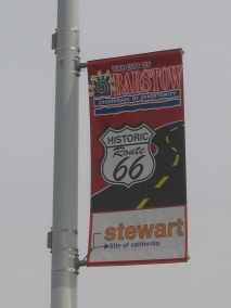
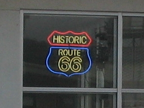
Mother’s Day was coming up and what did I want to do on my special weekend? Go back to Route 66, of course – to do some more exploring on the Beale Wagon Road, and also to see Thomas the Train. A real life-sized Thomas was going to be at the Grand Canyon Railway, which intrigued me because we’ve been fans of Thomas the Tank Engine ever since the original series narrated by Ringo Starr.

Tickets for “A Day Out With Thomas” were $20 for a 20-minute ride with Thomas pulling the train. This was a lot cheaper than $60 per ticket for a regular train ride on the Grand Canyon Railway, but it would still be almost $100 for a family of five. So we were debating about whether it was worth it or not, but by the time we got around to solidifying our plans, the tickets for the days we wanted were all sold out. Then I had an even better idea! When you’re on the train you don’t get to see much of the engine anyway. But what if we were able to park or walk next to the track somewhere and just watch it go by? We’d be able to see it for a good long time that way.

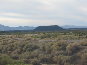
To get an early start, we drove up north on Friday night to camp in the forest near Williams. From I-40, we got off on Parks Road (which is Old Route 66). After a while, Parks Road just kind of turns into Forest Road 74 and heads north past the Pittman Valley Helibase and an El Paso Natural Gas compressor station. We turned right on a dirt road across from the natural gas facility and set up our tent there. It was quite cold in the woods at night (50º when we checked). The compressor station was so noisy, it seemed like it could be heard for miles around, but we didn’t bother moving.

The next morning before heading in the direction of Williams to see the train, I wanted to look for some more of the Beale Wagon Road while we were up there. The place that I had in mind was not too far from where we camped. As it turned out, it was even closer than we thought because we made a big loop around and ended up back on FR 74 right where we had started from!

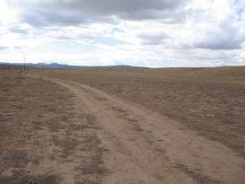
The way we had gone was, we went to Parks and at the Maine Consolidated School we headed north toward Spring Valley. We were looking for signs of the Beale Wagon Road and finally found one where the road turned westward at the corner of a large ranch. We followed the Beale signs through the forest, although they seemed to be few and far between. Then we looked for the turnoff to Laws Spring. We found it, but we were unclear as to how far it was and where to go next.

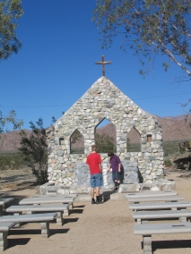
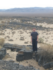
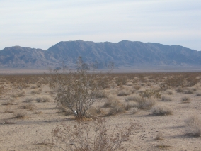
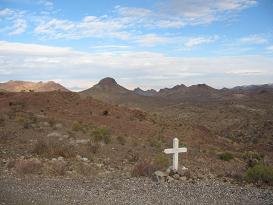
We just kept driving north on that dirt road, being careful not to get off on any side roads, and eventually we found the trailhead for Laws Spring. It had a rather large parking area, despite being in a remote piñon-juniper woodland with no one else around for miles. We hiked down to the spring which was only about a quarter mile. There we came upon a huge pool of water fed by a spring and surrounded by a neat rock outcropping. There were ancient petroglyphs on the rocks, as well as historic names and dates carved by Beale’s men and others who passed that way.

The trail continued on for a quarter mile past Laws Spring, where in the middle of a flat plain there was another marker for the Beale Wagon Road. I thought a wagon road would be so well worn that the tracks would last forever, but there was no evidence of it at all. We wouldn’t have known it was there if it wasn’t for the signpost.

If you’re interested in exploring the Beale Wagon Road, here are some tips:

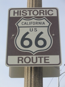
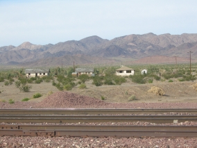
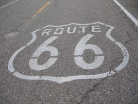
Beale Wagon Road traverses the northern part of the state, running east-west, primarily north of and roughly paralleling Interstate 40. Many forest service roads are presently located where the Beale Road used to be, and other roads intersect the Beale Road as well, so there are a variety of access points. Forest Road 141 out of Parks is suitable for passenger vehicles, but on most forest roads a high clearance vehicle is recommended. Good places to look for the Beale Wagon Road include: Leupp, Government Hill, Laws Spring, and west of Seligman. Depending on the area, the Beale Wagon Road route may be marked with rock cairns, brass cap markers, tree blazes, and 4" by 4" wood posts.

It’s great that the Forest Service is currently developing the Beale Wagon Road into a recreational trail. Laws Spring is the only parking facility along the route so far, but more trailheads with interpretive signs are planned in the future. Portions of the historic route that are part of the forest road system may be accessed by any means, including motor vehicles and mountain bicycles. The off-road trail sections are open only to hikers and horseback riders. A pathway has not yet been cleared on the trail sections, so it can be a challenge to follow – but that’s part of the adventure isn’t it?

http://www.fs.fed.us/r3/kai/recreation/trails/handouts/wil_beale.pdf (Click here for a Printable Map from the Forest Service.)

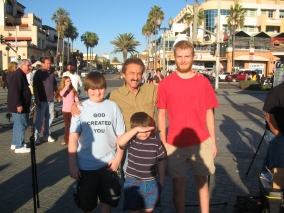
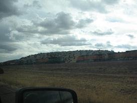
Next on our agenda was the Grand Canyon Railway in hopes of seeing Thomas the Train. We spotted the cute little blue tank engine at the station as soon as we pulled into town. Contrary to what we were led to believe, however, Thomas wasn’t pulling the train at all. In fact, he wasn’t even a working engine. Thomas was attached to one end of the train and a real diesel engine was at the other end. When the train left the station, it was pulled away by the diesel engine and Thomas simply trailed behind like a caboose. The train just went back and forth on the same track, ten minutes out and ten minutes back. So when it returned to the station, the real engine would be pushing from behind, making it look like Thomas was pulling the train. All Thomas did was whistle “Pip, Pip” all day long. Maybe it fooled the two-year-olds, but even my 7-year-old could tell that it was a fake. Now my kids all make fun of me for wanting to see it in the first place, but I’m still glad that we did. Watch the video below and you can say that you saw it too!

http://www.knowledgehouse.info/Thomas.wmv

Labels: , , , , , ,

Wednesday, February 14, 2007

ASH FORK ~ February 11, 2007

Ash Fork is located in northern Yavapai County at the junction of State Highway 89 and Interstate 40, along Historic Route 66 which runs the length of the town. A large monument in the center of town tells about the history of Ash Fork. For many years, stage coaches headed for Prescott started from here. Visitors can see some businesses here that have been in operation since the 1920’s - and from our more recent past, a computer store on the corner in which you can still see a big poster in the window announcing “Welcome to the World of Windows 95.” Ash Fork was named for the ash trees that grew on the town site. Today, Ash Fork is known as the Flagstone Capital of the United States. Elevation: 5,128 feet.

The original transcontinental railroad line that the Atlantic & Pacific constructed in the 1880’s became part of the Santa Fe Railway’s main line connecting Chicago and California. Like the Beale Wagon Road, the Arizona section of this railroad generally followed the 35th parallel in crossing the northern part of the state. The northern Arizona towns of Holbrook, Winslow, Flagstaff, Williams, Ash Fork, Seligman, and Kingman owe their existence to this railroad. The railroad dominated the economy and served as a lifeline to civilization for the towns along its route, which were otherwise isolated settlements in the middle of the wilderness.

Labels: , ,

BEALE WAGON ROAD ~ February 11, 2007


We were driving down Route 66 from Kingman to Seligman, through the little towns of Hackberry and Valentine. Just before Truxton, we got off on a side cattle road to have a picnic lunch. It was a grassy area with rolling hills, and we didn’t see any cattle although a herd of pronghorn was grazing nearby. The railroad runs parallel to Route 66, and we stopped just before we got to the track. While we were there, several freight trains passed by. After lunch we walked down to the tracks and waited for another train to come by. We waved at the engineer, and he blew his whistle and put his hand out the window to wave back at us.

The dirt road that we were on ran alongside the railroad tracks, and we decided to drive that way for a while because we thought it might lead us to Truxton. It didn’t, but we made an exciting discovery. Along the dirt road there were BLM markers that said “Historic Beale Wagon Road 1857-1883 BLM AZ Heritage Project 1993.” Suddenly it all made sense! The modern-day roads and development followed these historic trails, of course, over which people had traveled through the centuries and built up towns along the way. So if you go all the way back to its original beginnings, Route 66 was even more historical than we thought. It was so cool to think we were traveling on the same path that wagons had traveled on in the 1800’s.

After we got back home, I did a little research on the Beale Wagon Road. In the late 1850’s, Lieutenant Edward Fitzgerald Beale and his party of men set out on a route along the 35th parallel to construct a wagon road from Fort Smith, Arkansas to the Colorado River. Beale’s road roughly followed Lieutenant Amiel Whipple’s trail west across Arizona. They took a detour around Canyon Diablo, continued on through the Flagstaff area, headed northwest through Peach Springs and Truxton Wash (named for Beale’s son), then through Kingman and on to the Colorado River. Portions of this historic trail are still visible near the Navajo community of Leupp, at Laws Spring northeast of Williams, and between Valentine and Peach Springs.

This wagon road was once the major “interstate highway” across the northern Arizona Territory during the 1860’s - 1870’s. It traversed deserts, forests, and prairies. Deer, elk, and pronghorn antelope were commonly seen along the way – and they’re still there, as we observed. Modern roads, most notably Route 66, indeed followed the Beale Road alignment. Two of the best preserved original stretches of the Beale Wagon Road are northeast of Williams - the open grasslands of Government Prairie and dense pinon-juniper woodlands near Laws Spring. From Laws Spring, hike about 1/4 mile south and east along the marked trail to discover a segment of the original road that appears as two rows of rocks about a wagon-width apart.

http://www.southwestexplorations.com/bealemap.htm - Beale Wagon Road Navigation Map. (See also: http://www.tomjonas.com/swex/beale.htm)

http://www.fs.fed.us/r3/kai/recreation/trails/wil_beale.shtml - Printable map of Beale Wagon Road Historic Trail #31, from the U.S. Forest Service.

http://jan.ucc.nau.edu/~rse/riordanrt66.htm - Route 66 and Northern Arizona: Presented at the Riordan Mansion Brown Bag Lunch Sessions on June 13, 2000.

Did You Know…? Beale is most remembered for using camels in his road-building expeditions. Camels can travel for days without water, they eat more types of forage than mules do, and they can also carry heavier loads than mules. Beale’s camel driver, Hadji Ali (Hi Jolly), later lived in western Arizona. Ali's grave in Quartzite is marked by a stone pyramid topped by a copper camel.

Labels: , ,

HISTORIC ROUTE 66 ~ February 11, 2007

U.S. Highway 66 (aka “The Mother Road” and “Main Street USA”), established in 1926, covers a distance of 2,300 miles from Chicago to Los Angeles. During the Great Depression in the 1930’s, thousands of families emigrated from the Dust Bowl to fertile lands of California by way of this road, most of which was unpaved at that time. Paving was completed by 1937.

After World War II, Route 66 became the scene for glamour and adventure, enticing many to travel and experience the life of the open road. In the 1950’s, Route 66 became popular with families taking cross-country trips and vacations to the scenic Southwest. The popularity of automobile travel coincided with the rapid expansion of independently owned roadside motels, trailer courts, gas stations, souvenir/curio shops, and drive-in restaurants.

Route 66 and its attendant structures pretty much fell by the wayside with the advent of Interstate 40, when high-speed travelers became more interested in making good time than in having a good time. The last active piece of Route 66 near Williams, AZ was decommissioned in 1986. Today, Route 66 attracts nostalgic visitors seeking to recapture that old spirit of adventure and fun while enjoying Arizona’s classic scenic beauty.

The longest remaining continuous stretch of the original Route 66 is located right here in Arizona, running from Topock to Ash Fork. On this trip we had already traveled the portion from Topock to Oatman and Gold Road. From there we continued on through Kingman, Hackberry, Valentine, Truxton, Peach Springs, Seligman, and Ash Fork. It was a really nice drive off the beaten path, one of the most enjoyable routes we’ve ever taken. Once we left Kingman it was like we had the whole road to ourselves, so it was the perfect place for our 16-year-old student driver to obtain miles of experience – no mountains on this part, either, just rolling hills and sweeping vistas across far-reaching plains.


Things to See Along the Way:

Hackberry General Store, Hackberry School, Valentine Indian School, Little Red Valentine Schoolhouse (Mile Post 86), Valentine Post Office Ruins (Mile Post 87), Hualapai Indian Nation, Grand Canyon Caverns (Mile Post 115), Seligman Barber Shop/Route 66 Museum, Snow Cap Drive-in, Ash Fork Monument.

http://www.route66giftshop.com/main.html - Angel Delgadillo and his brothers and sisters grew up watching the traffic flow by on America's Main Street, starting with the folks from the Dust Bowl Era driving by in their automobiles full of everything they owned. It was an amazing caravan of poor folks heading west, seeking opportunities to better their lives.


Labels: , , , , , , ,

GOLD MINE TOUR ~ February 11, 2007


Located 2½ miles east of Oatman, AZ on Historic Route 66, the Gold Road Mine offers tours to the public. It’s open daily from 10:00 am to 5:00 pm. We were there bright and early on a Sunday morning for the first tour of the day. We were the only ones there at that time, too, which was great because our family had the tour all to ourselves and it was like we had our own personal tour guide. He was a great guy, too, and we gave him a tip afterwards which he obviously appreciated. The basic one-hour tour is $12 for adults and $6 for kids 12 and under. Group rates are also available at $11.00 per person for groups of 10 or more.

The Mine Tour is a walking tour, but transportation is available for the physically challenged. First, you will meet a nice lady in the main office. You are required to wear a hard hat and sign a liability waiver. Have your kids go to the bathroom there before you head up to the mine. For the tour, you will be transported in a tractor-like vehicle up to the mine entrance. The guide will take you into the mine approximately one-eighth of a mile. The mine is well-lit and there is safety fencing blocking off certain areas. You are invited to bring along your camera or camcorder and take as many shots as you please.

Going into a real underground gold mine was an exciting experience, and the tour guide was interesting and informative. He helped us to imagine what it must have been like in the old mining days. He shows you side shafts, mine cars, an elevator, a “widow maker” drill and other equipment that they used. At one point you can gaze down into a 1,400 ft. deep dark pit, but the wire fence was bowed out from people leaning on it to get a good look, so you wouldn’t catch me getting too close! About half way through the tour you will be standing directly under Route 66, which is a good picture-taking spot. Then the guide takes you into the original “Glory Hole” where you can see the gold-filled quartz veins. We even got to see a real tectonic plate that was exposed and lines one side of a shaft – it looks like a large flat smooth slab of rock.

Hard-rock miners worked three shifts a day, drilling, blasting, and hauling. Then the ore would be soaked in cyanide to extract the gold. Some quartz veins contain a higher percentage of gold than others, and the lesser quality veins are left in place because it’s just not worth the trouble to dig them out for such a low concentration of the yellow metal. At the end of the tour they let us take a bunch of ore samples home – which in itself was worth the price of the tour for us rock hounds!

It was in 1900 when a Mexican prospector named Jose Jerez was out searching for his lost burros. He stumbled over a chunk of quartz that glistened brightly in the midday sun. Upon examining the rock, Jose saw that it contained some gold. He took it in to have it assayed and it came out to 40 ounces per ton. Some investors purchased his claim, which then changed hands several times. By the end of 1907, the Gold Road Mine had reportedly produced 140,625 ounces of gold worth $2,250,000.00. Since then, the Gold Road Mine has been in production on and off now for about a hundred years.

During World War II, the government needed other metal types for the war effort, so the miners were taken to other areas and the Oatman mines were closed. The Gold Road Mine was re-opened in 1995 and it produced about 40,000 ounces of gold annually until the market price of gold dropped in 1998. Production costs alone were $271 per ounce, so most of the workers were laid off and moved away while the gold in the mine awaited a better day. A few employees stayed behind to provide these great mine tours. We were told that the mining company recently invested in some new equipment and may be getting ready to gear up production again once the gold price is right.

Visit www.goldroadmine.com for details on the Gold Road mine tour. Also click on “Mine Safety” for important information about the hazards of abandoned mines – a must-read if you plan on exploring the area. Curiosity can be deadly when it comes to old mines. So if you’re tempted to venture into a real gold mine, do it safely and enjoy this exciting guided tour.

Labels: , , , ,

A HAUNTED HOTEL AND A MYSTERIOUS CAR ~ February 11, 2007

The Oatman Hotel is listed on the National Registry of Historic Buildings. It has 10 rooms and is the only two-story adobe building in Mohave County. The Gable/Lombard Honeymoon Suite has been refurbished to the period when Clark Gable and Carol Lombard stayed there. The legendary Hollywood couple often returned to the place where they spent their wedding night in 1939. It is said that guests and staff can sometimes still hear the pair whispering and laughing in that room.

The ghost of “Oatie,” an Irish miner, is also said to haunt one of the guest rooms. One time a professional photographer took a picture of the empty room, and a ghostly figure appeared in the developed print. We were able to peek inside those two rooms, but most of the others were closed. The rooms were small, the bathrooms were down the hall, the furnishings were antique, and the floor was creaky, but we didn’t sense anything spooky. Quite the opposite, it seemed pleasant and I kept thinking how the place must have been pretty lovely and lively in its former life.


Although we didn’t see any ghosts, a strange thing happened to us while we were in Oatman. There was an old car – an Edsel I think – painted primer gray with whitewall tires and a historic vehicle plate. That car seemed to appear and re-appear everywhere we were. We were joking amongst ourselves saying that it must be the phantom car of Oatman or something. The driver always stayed inside the vehicle and all I could see was a shadowy figure dressed in black. Later on at home when I was telling my mom that story, she suggested the possibility that he may have been stalking us. So that got me to wondering, and gave me a creepy feeling when I started thinking about it.


Since we had camped in the area overnight, we arrived in Oatman way early in the morning before the shops were open, so it was kind of neat that we had the place all to ourselves before the tourist crowd arrived. We walked up and down Main Street, then visited the hotel. The first time we saw this unusual car, it was parked off to the side at the top of the street. Then when we were standing in front of the hotel, I asked Rich if he could walk down the street a ways to take a picture. The minute Rich walked away, that car started up, made a u-turn, and pulled up right next to our three boys. I was standing on the other side of a big post so I still didn’t see the driver. Rich had snapped a quick picture and came running back so he wasn’t gone very long and we walked away.


Soon after that, we got in our car and left Oatman, but we decided to stop at a gold mine on the outskirts of town. Oatman is located on a desolate mountainous part of old Route 66, and after leaving town the road starts winding up the mountainside. When I looked back to see Oatman one more time, I noticed that the old car was also leaving town in the same direction that we were going. Well, we decided to stop at a gold mine on the outskirts of Oatman, and when we were stopped at the gold mine I saw that car going up the mountain road past us. So it should have been long gone by the time we got out of the one hour gold mine tour, right? Well, after the tour we got back on the road, continued on up the mountain, came around a corner, and there it was! It was parked up at the top of the hill above the mine, as if waiting and watching for someone (us?) to come by.

Now that was uncannily reminiscent of Steven Spielberg’s “Duel” thriller starring Dennis Weaver. In that movie, a mysterious truck with an unseen driver kept following him and trying to run him off the road, which was in a desert canyon country just like this. I kept watching for that car the rest of the day expecting it to turn up again somewhere, but once we left the Oatman area I never saw it anymore. It did show up in one of the photos that we took, though! Hmm, I think that scenario would make for a good imaginative story starter.

Bu the way, the road from Oatman to Kingman is steep and narrow with several sharp hairpin curves, not suitable for vehicles over forty feet in length. The road to Oatman from Topock is not nearly as steep and doesn’t seem like it would be as dangerous, although we saw more roadside crosses between Topock-Oatman than we did on the Oatman-Kingman road. Please drive carefully!


http://www.oatmangoldroad.com - Oatman-Gold Road Chamber of Commerce

Labels: , ,

OATMAN ~ February 11, 2007

Oatman is an authentic western town of the style that is often copied by movie studios – a row of buildings on each side of a main street lined with wooden sidewalks. The town was named in honor of Olive Oatman, a girl who was kidnapped by Apaches after they massacred her family. The Apaches sold her to the Mojave tribe, where Olive lived for several years until she was rescued in 1857 near the site of the town. In its heyday from the early 1900’s to the 1940’s, Oatman was the largest producer of gold in Arizona, and once was home to thousands of residents. In 1930 the town boasted two banks, seven hotels, ten stores, and twenty saloons.


Route 66 had been built in the 1920’s, and after the mines closed down the town hung on, catering to the many travelers on the road. At first those old Ford Model A’s and Model T’s had to make the treacherous climb up Sitgreaves Pass and down several hairpin curves to Oatman. But in 1952, Route 66 was shifted to an easier more southerly route which bypassed Oatman and went through Yucca so cars could avoid the steep, narrow mountain road. Then when Route 66 was replaced with the I-40 interstate, Oatman suffered a final devastating blow. Today it supports only about 100 people year-round. Oatman is now a tourist town with gift shops and restaurants, since the historic Route 66 has became a popular destination for travelers from all over the world.


For years we’ve heard about the wild burros roaming the streets of Oatman but we didn’t see any when we were there! Apparently they had been there recently, though, because we had to watch where we were walking so we didn’t step in anything. In the afternoon there are supposed to be shootouts between costumed gunfighters in the middle of the main street, but we were there first thing in the morning so we didn’t see them either. Even so, it was well worth the visit to this photogenic old town and we got to go inside the “haunted” Oatman Hotel.

Labels: , ,

Tuesday, February 13, 2007

PARKER/LAKE HAVASU ~ February 10, 2007


After leaving Swansea, this time we headed west at the four-way stop to Shea Road and Parker. It was actually a better, faster road than the one from Bouse. Parker has a historic AZ & CA Railroad Depot with old coach cars on display. The gasoline prices seemed to be a lot cheaper in Parker compared to other places – perhaps a ploy to get Californians to drive over to buy gas? We drove across the river and back again for what the kids called our “30-second California vacation.” We drove up to Parker Dam and passed over the Bill Williams River where it flows into Lake Havasu. It’s hard to believe it was the same river that we were picnicking at upstream. The river was so much wider here and swamp-like due to the lake water backing up into it. There are some nice state parks along there, as well as a national wildlife refuge. But we didn’t stop because we were making good time and were eager to get through Lake Havasu City so that we could find a camp site before dark.

When we were passing through Lake Havasu City, a lady pulled up next to us at an intersection, honked, and pointed to our front tire which was totally flat and we hadn’t even noticed. We drove around for a while looking for a gas station – which of course are on every corner except when you really need one! Then Rich wondered if there was a Discount Tire in that town. Almost as soon as he said that, he spotted what looked like a Discount Tire sign down the road as we were turning right at an intersection, so we turned back around and went that way and sure enough, it was a Discount Tire store. But it was going to be closing in just five minutes! Even so, they cheerfully took us in and checked our tires, and the rear tire was flat, too. I thought it may have been from a sharp rock on our off-road escapade, but in fact both tires had nails in them. I guess we must have picked them up in the ghost town? Rich has road hazard insurance with Discount Tire so that was good; and we were so thankful that those guys were willing to help us at closing time. We were lucky, too, because we would have been in bad shape if that nice lady hadn’t honked at us and we had gone camping in the middle of the desert that night, then woken up to discover that we had two flat tires and only one spare! We had a guardian angel watching over us I think!

That pit stop had put us behind on our time, but at my request we took a little detour so we could say that we had driven over London Bridge. Then we continued northward on I-95 which veered east a little bit, so when we got to I-40 we had to head west. Topock was a strange little place with a bunch of white pipelines stretching over a narrow part of the river, adjacent to the same spot where an old bridge on Route 66 entered California. It looked like I-40 climbed up a hill toward the sunset on the other side, while we got off and went north to Golden Shores. It was a tiny little town with one general store, a pizza/ice cream shop that was closed, a liquor store/gas station and a fire station. That area felt dark and isolated, but not as lonely as we were going to get later. Everywhere else we go in the state, there are either cattle roads or forest roads that we can camp along. But do you think we could find a side road to get off on? We drove and drove, and there were all these weird little circular turnouts on the side of the road but no dirt roads that went anywhere. We were speculating as to whether those turnoffs were something left behind from the busier days of Route 66 perhaps. Finally when we started getting near the mountains we found a dirt road with a maze of others leading away in different directions, probably branching off to old mines. The whole area seemed abandoned, and there wasn’t another soul around. Yet way down across the plain to the West, we could see the twinkling lights of a city – Needles maybe, or Bullhead City?

Labels: , , , , , , , ,

Monday, February 12, 2007

Swansea/Oatman/Route 66 ~ February 9-11, 2007

Traditionally we like to take a Valentine’s Day trip, and since Valentine’s Day was on a Wednesday this year we decided to go on the weekend before. We’d been wanting to visit Oatman and the ghost town of Swansea for a long time, and ever since getting the Pixar “Cars” movie for Christmas, we’ve been interested in Route 66. So this was going to be our ghost town/Route 66 trip. While it may seem like ghost towns and Valentine’s Day don’t really go together, we did visit the honeymoon suite of Cary Grant and Carol Lombard, plus we got to drive through the town of Valentine, AZ!

Labels: , ,

Sunday, September 24, 2006

Petrified Forest/Painted Desert/Meteor Crater ~ September 22-24, 2006

This area is a geologic wonderland! Petrified Forest has stunning vistas, erosional landforms, barren badlands, and extensive displays of petrified logs as well as petroglyphs and remnants of prehistoric pueblos. Our journey from one end of the park to the other began when they opened and lasted until closing time. It doesn't take that long to drive the 24-mile scenic road, but we hiked all of the trails and stopped at every scenic overlook along the way. Nearby you can visit the best-preserved meteorite crater on Earth. Admission includes a guided tour of the crater rim that lasts about an hour, a film shown in the theater explaining the crater, and access to a state-of-the-art museum with lots of hands-on interactive exhibits. After staying overnight in Holbrook, we were going to make that a quick stop on our way home but ended up spending several hours there! Kids of all ages (and adults) who are interested in rocks and space science will love it!

Take a virtual tour! Each of the following photos will open in a new window.

Petrified Forest 1
Petrified Forest 2
Petrified Forest 3
Petrified Forest 4
Petrified Forest 5
Petrified Forest 6
Petrified Forest 7
Petrified Forest 8
Petrified Forest 9
Petrified Forest 10
Petrified Forest 11
Petrified Forest 12
Petrified Forest 13
Painted Desert 1
Painted Desert 2
Painted Desert 3
Meteor Crater 1
Meteor Crater 2
Meteor Crater 3

Labels: , , , ,